
It’s been a few days since our last post, but we’re very appreciative of the positive comments from the Quest team. They’re absolutely right, that our 200-model has served us very well indeed, and the body has proved to be very robust in tricky terrain. We are however, also very grateful for the spare-parts package that they sent to us. That proved to be invaluable. Over our time here, we’ve flown a total of 10 flights, and given the terrain, our UAV is looking very good indeed. We snapped a couple of wing-spars, and have chipped a few props, as well as a few other items, but the body of our UAV is looking very good.
Our work out here in Svalbard is now drawing to a close. The days are getting shorter, and we’re starting to see some snow appear on the tops.
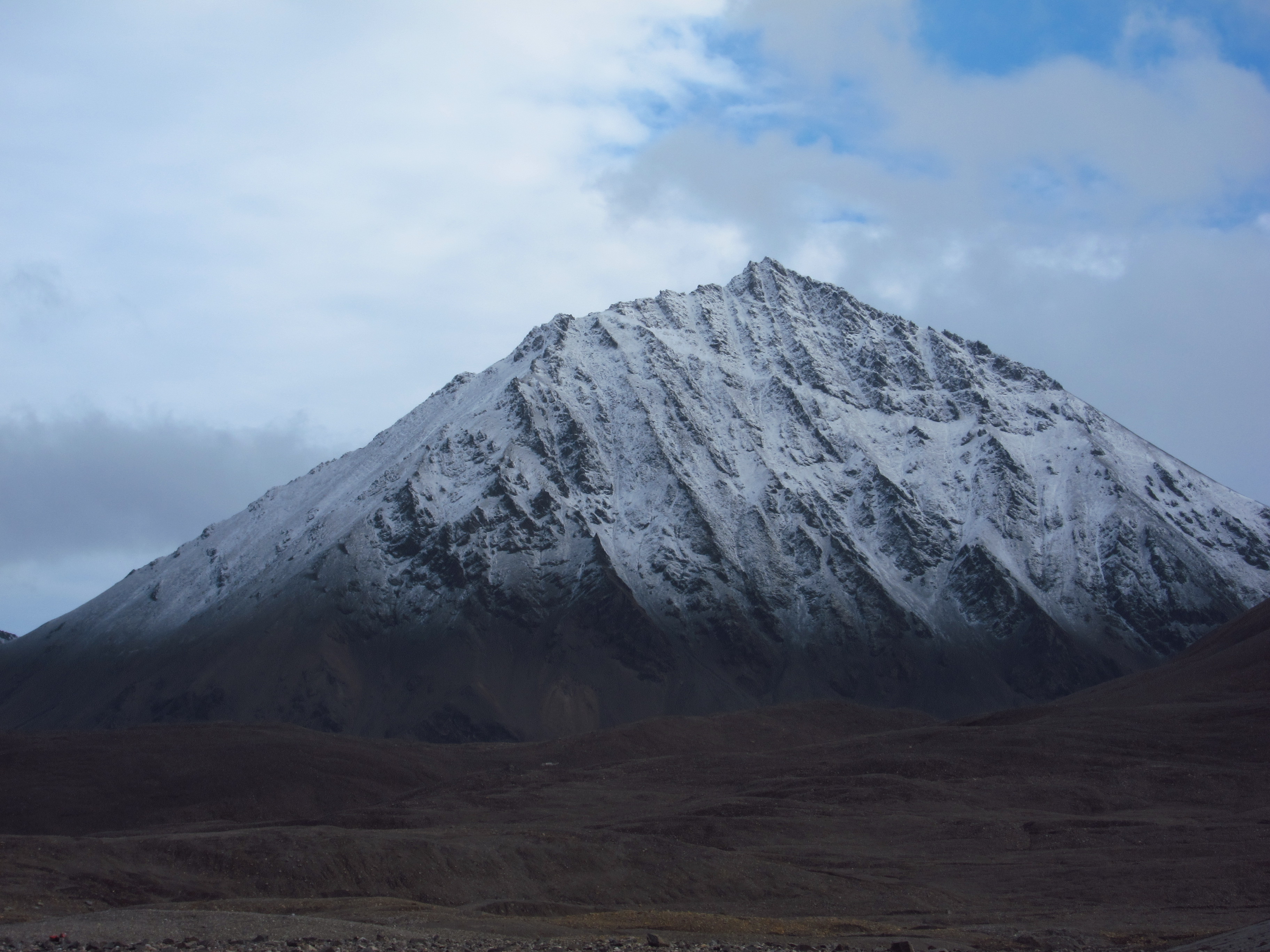
Snow begins to cover the higher mountains of Svalbard.
However, as we sit here in the nice, warm, NERC Arctic research station, we can reflect on some great successes. As the Quest team indicated, we’ve managed to collect a large suite of data…flight lines over the snout of the glacier Midtre Lovénbreen at a previously unprecedented resolution, covering more than 12 km of flying.
The image below shows one of our many images…

A meandering supraglacial channel on the glacier surface – the channel is about 1.5 m across.
…and when we put them all together, they look something like this:

Th snout of Midtre Lovénbreen (part of our ortho-rectified mosaic of 450 images). The ice is flowing towards us (roughly north) and it is a little less than 1 km across. The resolution of our imagery is astonishing.
We’re pretty pleased with what we’ve achieved, and are also amazed at how quickly our time here has gone by. Our UAV and other kit are now all packed up and awaiting shipping back to the UK. It’s perhaps worth pointing out that in addition to our flying, we also set out an array of bright-red markers on the ground, and in between flying sorties, we surveyed these markers using a Trimble R6 dGPS system to give us the ability to very accurately locate our imagery in the real world. We also spent half a day using our dGPS to measure the surface elevation of over 125 locations on the glacier surface. We intend to use these to assess the accuracy of the surface DEM we will derive from our flights, and to tune it if necessary. This is a crucial stage, if we hope to be able to identify changes in surface elevation when we compare our surface DEM with those collected in previous years using more traditional methods.
One final thing to mention, is that our work here in Svalbard has gained a lot of interest from the other scientists in the community in Ny-Ålesund. As a result, we were asked to give a talk earlier in the week to everyone here about our work. Despite getting minimal notice about this, and despite having just an hour to prepare (after getting back from the field), our efforts gained a lot of attention, both with respect to our science aims, and the platform we used (i.e. the QuestUAV 200 system).
So, all-in-all this has been a pretty successful trip. Thanks from both Andy and I to all the team at Quest for their unswerving support and encouragement. We’re looking forward to showing you our results (and getting our UAV a full-service!) when we return to the UK.

The sun begins to go down over Svalbard as the summer draws to a close.
